
The GOES program is a key element in NOAA's National Weather Service (NWS) operations. GOES weather imagery and quantitative sounding data are a continuous and reliable stream of environmental information used to support weather forecasting, severe storm tracking, and meteorological research. Evolutionary improvements in the geostationary satellite system since 1974 have been responsible for making the current GOES system the basic element for U. S. weather monitoring and forecasting. Spacecraft and ground-based systems work together to accomplish the GOES mission.
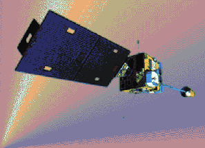
Designed to operate in geosynchronous orbit, 35,790 km (22,240 statute miles) above the earth, thereby remaining stationary, the advanced GOES I-M spacecraft view the continental United States, neighboring environs of the Pacific and Atlantic Oceans, and Central and South America. The three-axis, body-stabilized spacecraft design enables the sensors to "stare" at the earth and thus more frequently image clouds, monitor earth's surface temperature and water vapor fields, and sound the atmosphere for its vertical thermal and vapor structures.
See the NOAA Home Page for the latest information on GOES-8.
This document was excerpted from: http://pegasus.nesdis.noaa.gov/goes.html
Peter J. Topoly (ptopoly@nesdis.noaa.gov) 3/16/94